Section 6
There are quite a few changes in this section, and there is also a new alternative to the route through the Highlands. On Day 50, the forestry in Glen Garry has largely been felled, and this has involved the construction of new tracks and bridges. This has made the direct route via the Bealach Carn na h’Urchaire much safer in wet weather. On Day 55 a new track has made it a lot easier to get from Glen Douchary to Oykel Bridge via Strath Mulzie. On Day 61 I have rerouted the Trail to avoid the worst of the Moss of Killimster, which has cause a few walkers problems. Also, the latter part of the Day 61 now follows the new John O’Groats Trail, which has led to some route improvements.
The new option is to follow the Great Glen Way from Fort William to Inverness, then the John O’Groats Trail from Inverness to John O’Groats. The John O’Groats Trail is still under construction but you can walk it all now, much of it is already waymarked, and there is a draft guidebook. This will be replaced by a Cicerone guidebook when we’ve finished writing it! The John O’Groats Trail crosses the Kessock Bridge from Inverness, crosses the Black Isle and Easter Ross, then follows the coast north. Further information on the John O’Groats Trail is at www.jogt.org.uk.
Day 50 – Fort William to Glen Garry
- Map 1: Paragraph 3. The path no longer crosses the sluice: keep right of the sluice to join the lane.
- Map 1: Paragraphs 3 & 4. The housing estate has been extended, and while it’s still possible to get through it by a more convoluted route, it’s not really worth the extra effort and distance. Instead of entering the housing estate, just turn right along the road after crossing the bridge, then turn left on the A830. Cross a new roundabout then look out for the small path on the right.
- At the end of Map 2 you need to decide which way to go. The arguments have changed since the guide was first published. Firstly, new forestry tracks, paths and bridges mean that the route via the Bealach Carn na h-Urchaire is no longer the same trap in wet weather. The second is that there is no longer any accommodation available in Glen Garry apart from wild camping, so there is no point in visiting Tomdoun. The original Fedden route went past Tomdoun, whereas taking the Bealach Carn na h-Urchaire route involved a road detour to visit the Tomdoun Hotel. The Bealach Carn na h-Urchaire route is about 4 miles shorter than the alternative route via Fedden, and will be quicker. Both routes have sections of rough pathless walking, and about the same amount of climbing. The only advantage of the Fedden route is that it only climbs to 400 metres, whereas the Bealach Carn na h-Urchaire is at 648 metres. This could make a significant difference in cold or windy weather.
- Map 3 (Bealach route): There is now a hydro scheme on the Allt Dubh, but the climb is still along the same route, now on an improved track as far as the intake pipe.
- Map 4 (Bealach flood route): If there is a lot of water in the Allt Ailein and you think crossing it lower down could be an issue, cross it as soon as you can. Follow the burn down to a new deer fence above the junction with the Allt an Fhithich. Climb the fence, then head north on a descending traverse to the stream. Follow it down and you will soon find a built path that leads down to a bridge just above where the “small reservoir” is marked on Day 50 Map 6. Turn left over the bridge and follow the forestry road for about 5 km (3 miles) to cross a bridge over the Allt Choire a Bhalachan. You then reach a T-junction: turn left and follow the forestry road down to the bridge at the foot of Loch Poulary.
- Map 4 (Bealach route): If the Allt Ailein is not in spate, keep it on your right, and there’s a gate in the new deer fence on this side. Continue on the main route to the edge of the forestry (this involves two burn crossings, and if you can’t cross them you will need to follow the flood route described above instead). Assuming you reach the edge of the forestry you will find the trees have been cleared, the fence has gone, and there is a new track along where the fence used to be. Ignore this and follow the path straight on into the cleared area. When you meet a forestry track, turn right along it for a short distance to meet a forestry road. Turn left here and you are on the same forestry road as the flood route takes, not far from the bridge over the Allt Choire a Bhalachan. As above, turn right at the T-junction after the bridge and head down to the valley bridge.
- Map 5 (Fedden route): There is also a hydro scheme in Gleann Cia-aig. The route is essentially the same, but the path in the lower section is now a hydro access road, with an added zigzag.
- Map 5 (Fedden route): There is now a deer fence to cross just below where the paragraph marker “3” is on the map. There is a gate, which you will have to climb, and the route is unchanged as the gate is on the original line across the pathless peaty moorland. At the point where you leave the fence you can actually see the gate in the distance: aim a bit left of it initially to avoid the worst of the peat hags. When you reach the edge of the trees the fence is no more, but there is a built path down from here to the forestry road. Turn left down the road (which now continues to the right as well).
- Map 6 (Fedden route): There is now a much easier and tarmac-free way to get to Loch Poulary, due to the new forestry roads and bridges. When the descending track meets the T-junction, turn left and stay on this track. Cross two bridges (there are camping spots by the second bridge), then keep right on the main track when there is a left fork. Just over 1 km further on, the track forks again: take the main track uphill to the left, which takes you to the bridge just above the “small reservoir” (see the description above of the flood route and Map 6). Follow the forestry road to the next bridge, turn right at the T-junction, and descend to the valley bridge.
- Note that the decrepit bothies there used to be at Garrygualach are no longer there, and that the riverside route from Garrygualach to the Allt Choire a Bhalachain is wet, slow, and mainly pathless. I wouldn’t advise going that way.
- If you want to get to the valley road from the Fedden route, the path from the “small enclosure” to the first burn can still be followed if you can find the start of it, but then it gets tricky due to the brash from felled trees which has obliterated some of the path. You can still get through if you persevere though. Alternatively, turn right at the T-junction at the start of Map 6, and in 2 km turn sharp left at a track junction. This track takes you to Greenfield.
Day 51 – Glen Garry to Glen Affric
- Map 1: Paragraph 1. There is a misleading path crossing the stream just before the first fence corner. Keep right here: the through path crosses the stream some way above the first fence corner.
- Map 2: Paragraph 3. There is now a fence to your right as you bend round above the River Affric. Stay up near it until you reach a stile near the bridge: don’t drop down to the valley bottom before this.
Day 52 – Glen Affric to Bendronaig Lodge
- Map 3: Maol-bhuidhe is an MBA bothy. There is a path down to the river from the bothy, which is easier to follow than the pathless route on the left of the stream.
- Map 3: Paragraph 4. There are new hydro works above Bendronaig Lodge, and a new road bridge replaces the old footbridge. Don’t descend to the old footbridge: go right to join the new track. Turn left over the new bridge for Bendronaig Lodge.

Day 53 – Bendronaig Lodge to Kinlochewe
- Map 1: Paragraph 1. “When it disappears at a burn…”: there is now a bridge here.
- Map 1: The building marked on the left bank of the Abhainn Bhearnais is Bearnais Bothy (MBA).
- Map 2: Before committing yourself to a stay at Gerry’s hostel at Craig it’s advisable to sear h the Web about it to find out what you may be in for.
- Map 3: Hydro works in Glen Coulin have made quite a mess. Some of these works in other places have kept tracks narrow and tried to keep disruption of the environment to a minimum, but this can’t really be said of Glen Coulin. Having said that, it will look a lot better in a couple of years. Access to the hydro works has followed the route of the Trail more or less, so the route is easier than it was in some places.
- Map 3: End of paragraph 1. Enter the forestry on the wide track above Torran-cuillinn, at the forestry corner. It’s not worth the effort of fighting up the old path.
- Map 3: Paragraphs 2 and 3. Stay on the main track, which climbs out of the trees, across the moor, then enters cleared forestry through a gate at its corner (just below “gateway” on Map 3). Stay on the track as it descends the slope, until it bends sharp left near the valley bottom. Turn right here on an old track that traverses the slope parallel to the valley bottom. This track ends a few metres from the gate out of the forestry by paragraph marker 4.
- Map 3: Paragraph 4. There is now a path (just) from this gate to the gate near the ruin, and you need to follow it as a new deer fence has been built. There is some route marking. There is a high chance of picking up deer ticks along here, as you will have to push through bracken, so cover up well. The narrow path follows the stream down to go through a gate. Cross the stream after the gate and keep a fence on your left past the ruin until your reach a gate: this is the gate just above the ruin on the map.
Day 54 – Kinlochewe to Inverlael
- Map 1: There is new hydro power here as well, and some new fences, but the route is unaffected. The bothy at the Heights of Kinlochewe has been replaced with a new house, but there is a bothy 2.5 km to the east along the track (Leckie).
- Map 3: Shenavall bothy is 2.5 km down the valley from Achneigie. You can rejoin the Trail from Shenavall on a path that rejoins the Trail just after the “A” marker on the map.
- Map 4: Paragraph 3. The path now continues above Croftown, descends to gates, then crosses a field diagonally to a gate at the crossroads. It is signed.
Day 55 – Inverlael to Oykel Bridge
- Map 1: Paragraph 1. The phone box has gone: cross the stile between the house and the car park.
- Map 1: Paragraph 2. It’s now easier to follow the vehicle tracks to the cairn than cross the rough ground to the left. They lead just right of the cairn.
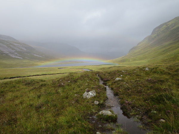
- Map 1: Paragraph 3. For the new edition I have rerouted the Trail via Strath Mulzie, following a new track from Glen Douchary. I haven’t checked out either of the old routes recently, although they are probably still practical to follow. The new route is easier and quicker than either of the old options, but doesn’t give you the option of an overnight stay at Knockdamph bothy. The main issues with the old route are that (1) the descent along the River Douchary is quite difficult underfoot, and (2) there is a gorge crossing that can be confusing. To follow the new route, as you descend towards the River Douchary look ahead at the hillside opposite. You will see a track crossing that hillside. Cross the river, climb to the track, and turn left along it. It’s a bit rough initially but it soon improves, and it climbs out of Glen Douchary and descends to Strath Mulzie, joining the old Strath Mulzie route on Day 55 Map 3, by paragraph marker “2”.
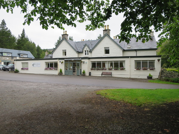
- Maps 3 & 4: There is good wild camping in Strath Mulzie, and the “hut (shelter)” at Duag Bridge is actually a small MBA bothy (the School House). The Oykel Bridge Hotel now has some cheaper B&B rooms for walkers. The best place for camping here is actually by the river just downstream of the bridge (cross the bridge and turn right down to the river).
Day 56 – Oykel Bridge to the Overscaig Hotel
- Map 1: Paragraph 2. There is a good spot to camp by the river about where the “R” of “River Oykel” is on the upper map section.
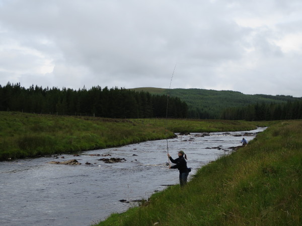
- Map 3: Paragraph 3. The best place to cross the river is at a shallow section about 250 metres from the loch, where you can cross via a grassy island. This is easier than the place suggested in the old guide, which is a little further from the loch.
- Map 4: There is a B&B next to the Overscaig Hotel: Oak Lodge.

Day 57 – Overscaig Hotel to Crask
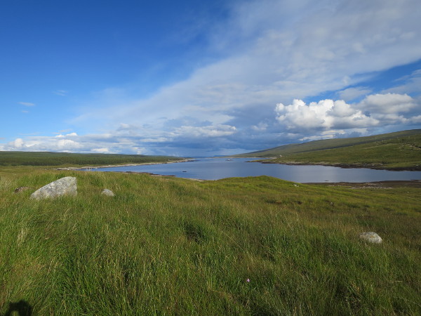
- Map 1: You can join the forestry track by climbing up directly from the Overscaig Hotel. If you’re at the hotel, above the entrance to Oak Lodge B&B you’ll see a gate up at the edge of the forestry. Climb up to it from the old Coach House, go through and turn left for a few metres to a ride. Follow this up into the trees, soon joined by a burn. Keep going up the ride until you reach the forestry track and turn right. It’s mainly pathless but not too difficult.
- Map 2: There is no longer a bunkhouse at the Crask Inn, as the former owner of the inn now lives in it. There is still B&B at the inn though, or you can camp on the lawn.

Day 56L – Oykel Bridge to Lairg
- Map 1: There is no longer a shop at Rosehall, but there is a B&B here at Invercassley Cottage (01549 441783). The Achness Hotel is a good place to stop for a drink and a meal, but you need to book a table to be sure of getting fed (01549 441239).
- Map 2: Paragraph 2. The middle of this paragraph should now read: “…Look out for a vague path branching of to the right & take this: if you reach a gate you have missed this branch…”.
- There is no longer a bank in Lairg.
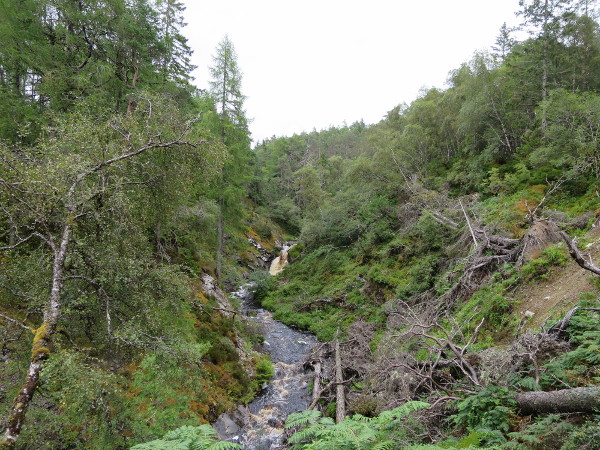
Day 57L – Lairg to Loch Choire
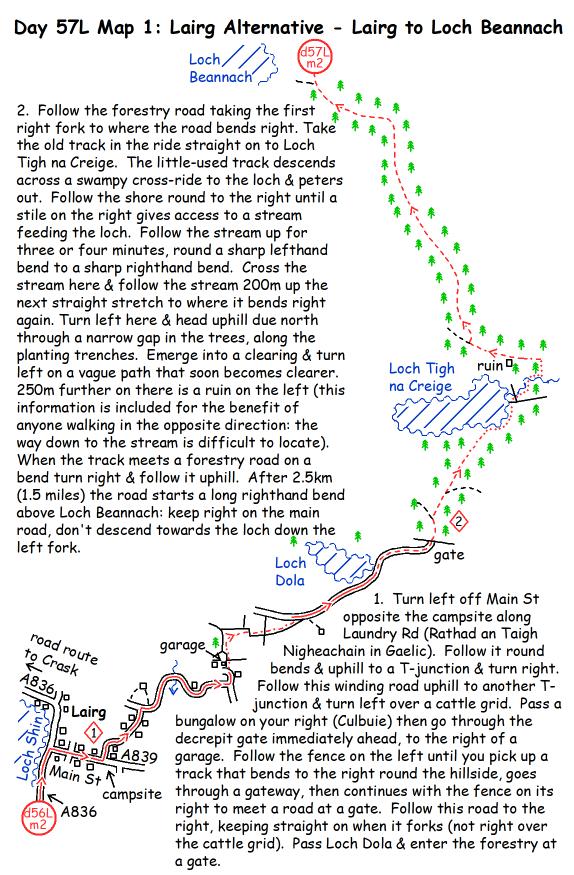
- Map 1: Paragraph 2. Storms have blown trees across the old route from the stream by Loch Tigh na Creige to the track past the ruin. Also, the first printing of the guide repeated Day 57 Map 1 instead of including Day 57L Map 1. Here’s the up-to-date page:
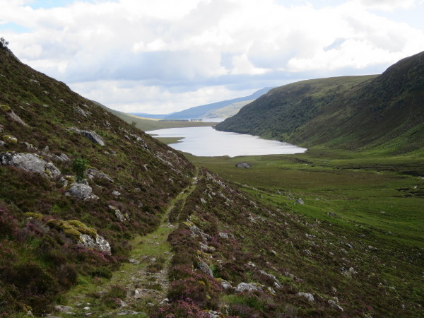
- Map 3: Paragraph 2. The point at which the path crosses the last burn on the ascent is no longer clear, as there is a vague path continuing up the burn, and the path on the far bank is not visible until you have crossed (it is obvious as soon as you’re on the far bank). It is important to find this crossing point, as there is a big featureless plateau ahead. I built a couple of small cairns here, which should help if there are still there. The remains of the old bridge are not obvious, so don’t help to identify the crossing point.
- The hut at Loch Choire is now a proper bothy, maintained by the estate.
Day 58 – Crask to Kinbrace
- Map 2: The hut at Loch Choire is now a proper bothy, maintained by the estate.
- Map 4: Paragraphs 1 and 2. The old route to Kinbrace from Badanloch Lodge doesn’t work any more due to a missing stile, forestry felling and a blocked gate. Additionally, the footbridge at Kinbrace is no longer usable, and although there is another bridge a bit upstream, getting to it means fording Claggan Burn, which flows out of Loch Arichlinie. In wet weather, you should therefore follow the B871 to Kinbrace. If the weather is dry enough, follow the B871 to the end of the wall on your left (by paragraph marker “2” on the map). Turn left here up a track to the top of the wall and turn right on 140 degrees, back on the original route.
- Map 4: Paragraph 3. When your reach the first fence on the top map section the gate is blocked. Follow the fence east to a gate in the next corner, turn right through it, and descend to a gate on your left. Go through, and you are now back on the old route, where it says “gates” on the map. There is only the one gate now.
- Map 4: Paragraph 4. The footbridge is out of action. In dry weather ford the burn above the footbridge, or go further upstream to a bridge (fording Claggan Burn).

Day 59 – Kinbrace to Dail Righe
- Map 1: Paragraph 1. Forestry work and a new fence have changed the route slightly after crossing the railway. The line you follow is pretty much the same, but the middle of this paragraph should now read: “…At the railway, follow the burn under the bridge & turn right on the A897. Climb double gates on the left & aim half left in the field (85 deg), to a gate in the corner. The route should go through the gate & follow the fence to the left, but to avoid a swampy area cross the fence right of the gate & clamber through the felled area for 50m then join the fence. A gate gives access to the open moor beyond: continue along a line of fenceposts, with the burn on your left…”.
- Map 1: At the end of the page, when you’re looking out for the OS column, it is on the skyline.
- Map 2: Paragraph 5. Stay on the main track. It’s now very hard to find the old path to the right. You won’t see the waterfall, but it’s only a small one anyway.
- Map 2: There is now also a road barrier further down the valley at the outlet from Loch More.

Day 60 – Dail Righe to Watten
- Map 2: Paragraph 3. Just before the flooded quarries you cross a stream, which is a welcome source of fresh water.
- Map 2: Paragraph 4. There are new fences on this side of the river, and new fences and a new wind farm on the other side. As you follow the river bank after the flooded quarries, look out for any point at which you can cross safely. If you can cross, head for the ruin at Torran, then join the wind farm road. Fork right off this on the old access track for Torran, to reach the A9. Alternatively, if you reach a fence before finding a place to cross, turn right here and follow the fence to a gate. Go through or over (awkward), follow the fence and descend to a bridge. Cross, and follow the track up and left to Tacher Farm. Go through the farmyard and right along the drive to turn left on the A9. There is no longer any need to use the bridge further south. Tacher Farm no longer does B&B, but ask at the farm if you’re looking for somewhere to camp.
- There is still a shop/post office in Watten. There is no longer a shop at Keiss, so this is your last chance to buy anything before John O’Groats.
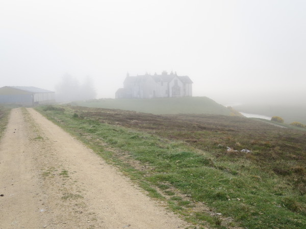
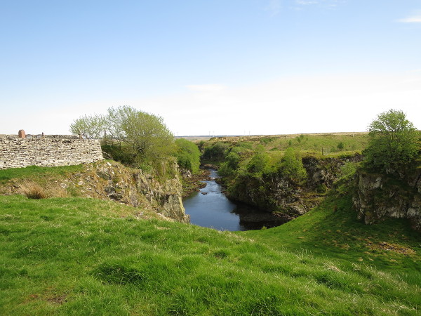
Day 61 – Watten to John O’Groats
- Map 1: For the new edition I have rerouted the second half of this map to avoid crossing the Moss of Killimster. Bilbster Forest has been felled, but the old route should still be possible to follow. It is however very hard work in very wild wet country with high vegetation. The new route follows the right edge of the Moss, and is a lot easier, although it does mean a bit more road-walking. Here’s the revised map:
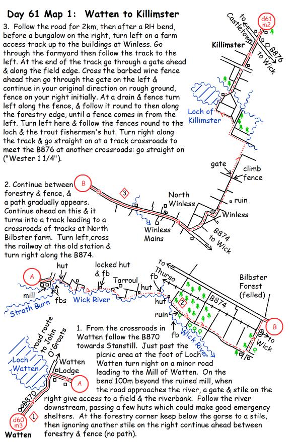
- Map 2: There is no longer a shop at Keiss.
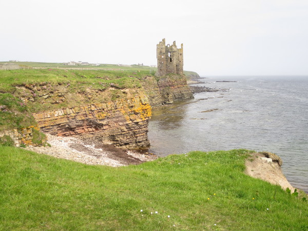
- Map 3: There are a number of minor changes due to the improvements made in creating the John O’Groats Trail, and there is no longer any need to follow the road through Skirza. Here is a revised map:
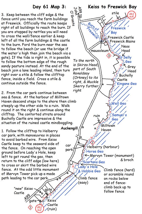
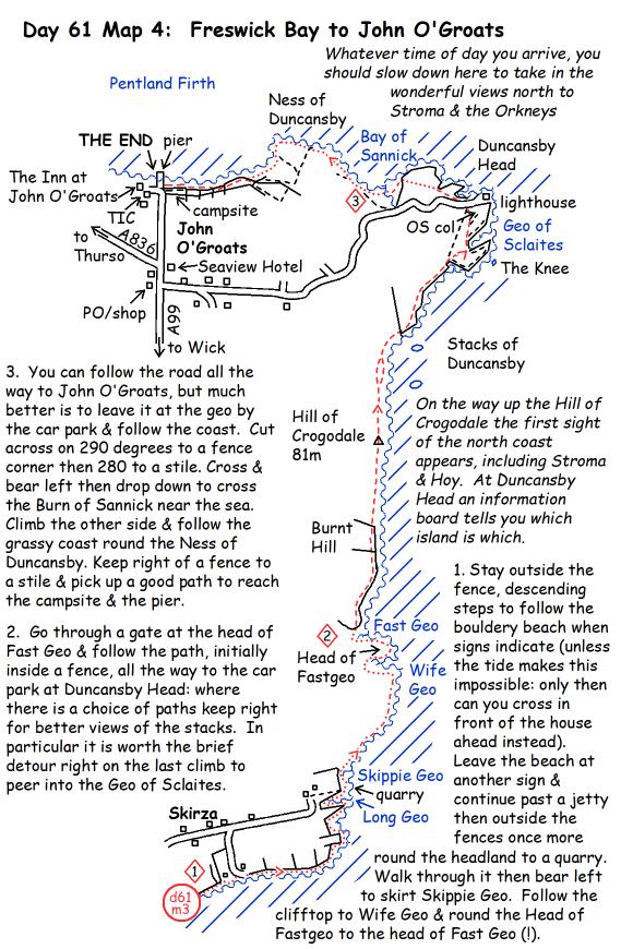
- Map 4: Again there have been some route improvements, in particular a better route from Duncansby Head to John O’Groats. There is no longer a B&B at Skirza. Here is the revised map:
